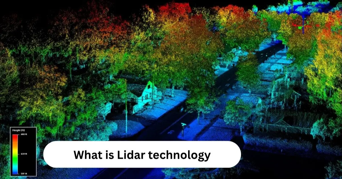
What Is LiDAR?
LiDAR technology is reshaping the way the modern world studies landscapes, measures distance, and builds accurate 3D models of the environment. It uses fast laser pulses to capture detailed shapes of objects, which helps experts understand places that are hard to reach. You’ll see LiDAR technology in everything from self-driving cars to climate research because it offers quick, clear, and reliable results.
Many industries now depend on this tool to improve safety, planning, and decision-making. When LiDAR technology collects data, it creates rich 3D information that makes complex surfaces easy to study. Professionals often use Light Detection and Ranging, 3D mapping, remote sensing technology, digital elevation models (DEM), and laser scanning system tools to explore large areas with strong accuracy.
Why LiDAR Technology Matters in Modern American Industries
Many places in the USA use LiDAR technology because it can measure millions of points very fast and create clear, detailed pictures of the land. Cities, farms, airports, roads, and seaports use LiDAR to spot problems early and make plans that keep people and property safe.
How LiDAR Works
To understand how LiDAR technology works, imagine light moving very fast. It bounces off an object and returns to the sensor almost immediately. Each reading uses time of flight measurement, which shows how long near-infrared laser pulses take to travel to a surface and come back. These tiny times allow the LiDAR measurement process to create very detailed 3D visualization for maps and models used in the USA.
The main part of How LiDAR works is laser pulses and reflections. These are supported by IMU and GPS integration in LiDAR to track exact location and movement. Every scan goes through LiDAR data processing steps. Computers fix mistakes, remove noise, and organize the results into LiDAR point cloud files. These files are ready for planning, modeling, or safety checks.
Time-of-Flight Principles Behind LiDAR Technology
Every LiDAR reading starts with speed and timing, so accuracy depends on clean LiDAR point cloud cleaning, reliable signals, and stable hardware. Engineers often convert this data into the LAS file format for LiDAR, which is the USA industry standard for processing large amounts of mapping data.
Types of LiDAR Systems
LiDAR technology falls into several categories in the USA, each designed for a different environment. Airborne LiDAR systems scan large areas from above and help teams build elevation maps or track coastline changes. Ground-based systems like Terrestrial LiDAR, Static LiDAR, and Mobile LiDAR give experts precise scanning power for local projects or moving vehicles.
Some LiDAR systems specialize in unique environments like rivers or oceans. Bathymetric LiDAR uses green lasers to study shallow water areas and complete coastal mapping for environmental teams. In deep space missions, Space-based LiDAR helps build planetary maps and supports navigation in difficult locations far from Earth.
Airborne, Terrestrial, Mobile, and Bathymetric LiDAR Technology Explained
USA engineers pick the right system by considering height, water depth, movement, and terrain difficulty. These choices shape everything from wildfire plans to transportation design and Mining and quarry surveying.
Key Components of a LiDAR System
Every LiDAR device contains a few key parts that keep it reliable. The LiDAR components include the laser emitter, sensor receiver, and onboard processor that calculates distance using laser pulses and reflections.
To improve stability, developers combine strong processors with IMU and GPS integration in LiDAR so the system always knows exactly where it is. This mix creates dependable 3D environment modeling using LiDAR and supports real-time safety systems for vehicles, aircraft, and heavy machines.
Laser Emitters, Sensors, IMU, GPS, and Processing Units
Modern American manufacturers use Compact low-cost LiDAR sensors that support faster processing and more energy-efficient work, making LiDAR cheaper and easier for many industries.
Benefits and Limitations of LiDAR Technology
LiDAR technology delivers detailed 3D visualization and high-resolution scanning, which gives USA teams a clearer picture of landscapes and objects. It performs well in night conditions, supports mapping roads and infrastructure, and reaches difficult areas that humans cannot safely explore. Engineers trust it because LiDAR accuracy and precision remains high even in large projects.
Despite strong advantages, LiDAR systems can face limits. Dense fog, heavy rain, and reflective surfaces sometimes affect the LiDAR measurement process. Costs also vary depending on the project type, especially when using airborne or specialized systems for LiDAR for hazard and disaster mapping.
Accuracy Advantages and Environmental Constraints That Matter in the USA
Many challenges reduce signal clarity, yet engineers still prefer LiDAR because the benefits outweigh these limits and help them plan safer American infrastructure.
Applications of LiDAR Across Different Industries
In the USA, LiDAR supports construction, aviation, energy, farming, geology, and more. Farmers rely on LiDAR applications in agriculture to study soil, irrigation patterns, and crop health for better production results. The defense sector uses LiDAR for aerospace and defense to map targets, guide unmanned vehicles, and track surfaces during missions.
Civil engineers use LiDAR technology for LiDAR in construction and mining, which improves measurements in active quarries and helps build accurate models for buildings and bridges. Environmental teams depend on LiDAR to study forests, track storms, and handle LiDAR for weather forecasting when predicting risk.
How USA Agriculture, Construction, Defense, and Energy Use LiDAR Technology
Energy companies use LiDAR for wind resource assessment and risk planning while geologists use it for analyzing rock formations, faults, and erosion along critical coastlines.
LiDAR in Autonomous Vehicles and Smart Cities
Modern American cities increasingly depend on Autonomous vehicles LiDAR to support self-driving cars and robotic machines. LiDAR sensors help vehicles detect obstacles through Real-time object detection with LiDAR, which keeps passengers safe at high speeds even in unfamiliar or changing environments. Engineers rely on LiDAR for autonomous driving when building advanced driver assistance platforms such as ADAS sensors.
These systems also support LiDAR for smart cities, where local governments use constant scanning to monitor traffic, manage streetlights, and reduce roadway accidents. American city planners use LiDAR to track growth patterns and improve future infrastructure.
AV Safety, Traffic Management, and Urban Planning Powered by LiDAR Technology
Smart cities in the USA use continuous 3D environment modeling using LiDAR to support safer traffic routes, efficient energy planning, and emergency response systems.
The Future of LiDAR Technology
The Future of LiDAR technology in the USA looks promising as companies develop faster, lighter, and more powerful sensors. New hardware will allow LiDAR to support drones, home robots, consumer electronics, and even medical tools. Researchers already use Autonomous robotics using LiDAR for warehouse automation and advanced navigation systems.
As the technology becomes more affordable, many small American businesses will access Compact low-cost LiDAR sensors for everyday tasks like delivery routing, small farm imaging, and safer construction monitoring. Innovation will expand the role of LiDAR across every region of the country.
Evolving Trends, USA Innovation, and Market Growth
USA companies continue expanding LiDAR research because it supports national defense, environmental planning, and next-generation transportation systems.
Difference Between LiDAR, Radar, and Sonar
Every sensing system works differently, and each supports different environments. LiDAR vs radar vs sonar matters because LiDAR uses light, radar uses radio waves, and sonar uses sound. LiDAR delivers the best precision for surface detail and elevation, which makes it ideal for American mapping tasks and infrastructure work.
Radar performs well through storms and long ranges while sonar specializes underwater. For this reason, USA engineers use each system in different locations depending on depth, terrain, and mission purpose.
Comparing Speed, Precision, and Use Cases
LiDAR excels at close-range detail, radar works best over long distances, and sonar uses sound for deep water and underwater navigation.
Final Verdict of LiDAR Technology
LiDAR technology continues to evolve across the USA and remains essential for mapping, planning, transportation, and environmental safety. Every part of the country depends on it—from farms to major cities—because its accuracy and flexibility solve problems that older tools could never handle. Engineers, developers, researchers, and government agencies will continue expanding its use as national demands evolve.
As American businesses adopt stronger LiDAR technology, they gain access to reliable mapping, faster planning, and organized data that supports long-term growth. It is clear that LiDAR will guide many USA industries into a future filled with automation, innovation, and intelligent design.
FAQs about LiDAR Technology
Q1. Does the iPhone really have LiDAR?
Yes, some iPhone models have a built-in LiDAR scanner that improves photos, AR apps, and depth sensing.
Q2. How far can LiDAR penetrate the ground?
LiDAR can’t penetrate solid ground, but it can reach a few inches into loose soil or sand depending on conditions.
Q3. What are the three types of LiDAR?
Airborne LiDAR, terrestrial LiDAR, and mobile LiDAR are the three main types.
Q4. How does LiDAR see through trees?
LiDAR sends many laser pulses that slip through small gaps in leaves, allowing it to map the ground beneath the canopy.
Q5. What can LiDAR not penetrate?
LiDAR cannot penetrate solid surfaces like walls, metal, or dense soil.
Q6. What does Elon Musk think about LiDAR?
Elon Musk has said LiDAR is unnecessary for self-driving cars and prefers camera-based systems.